

⚡ The Quick Scoop
The Vibe: A very short, very cold winter excursion filled with misleading maps, creepy ice formations, and peaceful snowy trails.
Must See: The bizarre icicles hanging near the frozen waterfall, and the beautiful, paved winter walk at the Mill B Picnic Area.
Shauna's Rating: 💎💎💎 (A perfect 3-Diamond winter quick-fix!)
Some of the best-planned adventures have the funniest hiccups. It was a cold December day, and I was absolutely craving a waterfall hike. When I plan a hike, I always do my homework. I open the AllTrails app, filter for "Waterfalls" in Big or Little Cottonwood Canyon, and specifically look for a trail someone has completed recently so I know there will at least be fresh footprints in the snow.
Hidden Falls seemed absolutely perfect! It was short, it was easy, and it was freshly reviewed. I downloaded my Gaia GPS map, packed my external battery, filled my water, and headed out. But as any seasoned hiker knows, even the best-prepared situations can throw you a curveball!
👇 Choose Your Path
The S-Curve Death Trap
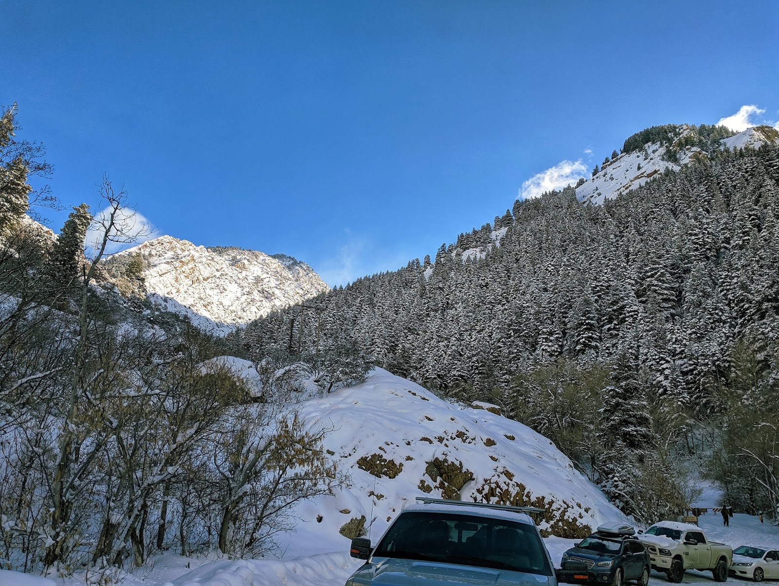
My first massive challenge didn't even happen on the trail—it happened in the car! The trailheads for Hidden Falls and Lake Blanche sit right on the famous, sharp "S-Curve" in Big Cottonwood Canyon.
🚗 Unplowed Chaos
Here is the crucial winter intel I wish I had known: the two parking lots in this area are not plowed in the winter! Because of this, absolutely everyone is forced to park parallel on the road right on that blind, dangerous S-curve.
People drive slowly, but trying to snag a spot quickly while navigating the curve is stressful. I ended up having to drive 15 minutes further up the canyon just to find a safe place to turn around and come back! And because the Hidden Falls trail heads North (unlike Lake Blanche which goes South), you have to cross this incredibly busy, blind road on foot.
Add in all the heavy traffic heading up to the ski resorts, and it can be a little terrifying! I stood on the side of the road doing a little dance just to keep warm. When a kind driver finally stopped, I had to do a very awkward, slippery jog across the icy road—you definitely don't want to hold up traffic or get hit by a car going the other direction! Maybe a Saturday morning winter hike here wasn't my smartest idea! LOL.
When the Maps Lie
I finally got safely across the road and pulled out my downloaded maps. I saw the trail marked clearly right there on my phone, but both my AllTrails app and my incredibly trusty Gaia GPS were telling me I was off course! :(
I walked up the road, searching the snowbanks, but I simply couldn't see another trail. According to the digital maps, the "official" trail didn't even get super close to the falls anyway. I was feeling a little desperate trying to figure out the trails and thought, "Well, now I understand why it got its name!" I saw some footprints in the snow heading off to the right, but the map seemed to say left, and I was just completely stumped.
I was feeling pretty frustrated when I got incredibly lucky: I saw a local man heading down the trail I had originally started on. I gave him my absolute best puppy-dog eyes and begged for help. He just chuckled at me and told me to head to the left—even though there were absolutely no footprints leading that way!
🧭 The Parable of the Path
It turns out, Hidden Falls is only "Hidden" because the maps lead you astray! It made me think about how life can easily get like that. Sometimes, even though we think we have perfectly prepared, downloaded all our maps, and are doing the absolute best we can do, we end up in a situation or on a path we didn't plan on.
In those cases? Talk to the Lord often. Ask for help. And just like my driving on that icy canyon road, don't be afraid to keep moving forward. Things will work out in the end; you just have to keep listening and asking for help.
Creepy Ice & The Frozen Falls
Following the stranger's advice, I found a nice set of footprints in the snow heading left. The hike is extremely short, but you do have to cross a small stream to get right up to the base of the falls.
🧊 Crossing the Ice
Crossing an icy stream can be a little stressful because the water is so snow-covered you can't even see it! I used my hiking sticks to aggressively tap the ice in front of me, making sure each step was solid before committing my weight. (Even if it did crack, it's a tiny stream, and if you have waterproof winter boots, you'll be just fine!)
Hidden Falls sits in a beautiful little cove with tall, icy cliffs on both sides. Standing in that narrow space is a completely unique sensory experience. Because it is a smaller waterfall, the sound isn't deafening, but you can hear the rushing water actively echoing and bouncing off the tight canyon walls. (I hear it is a very similar sound if you are brave enough to climb the upper section of Lost Creek Falls in the winter!)
👁️ The Creepy Ice Face
The frozen waterfall was a fun find, but honestly, I felt the bizarre ice formations hanging from the cliff walls were an even bigger reward! The icicles here freeze in the craziest shapes. One hung down on a pillar with a perfect disc shape on the bottom. Others looked like teardrops. But the most striking one actually looked like a creepy, frozen face staring right out of the ice! It almost looked like a strange sea creature with tentacles gripping the rock. Nature's winter art is so fascinating.
The Mill B Bonus Trail
By the time I finished Hidden Falls, I realized I had bundled up incredibly well, my heart was pumping from getting temporarily lost, and I was totally energized by the spooky ice face. But because the hike was so ridiculously short, I was standing there thinking, "Wait... I feel a little jipped! I have so much more energy!"
I knew I needed more of a workout. Right across the S-Curve is the Broads Fork Trail. While it doesn't have a designated "waterfall," it is such a steep, brutal hike that the river beside it is basically in waterfall mode the entire way up! Instead of tackling that beast, I decided to cross the road and explore the Mill B Picnic Area trail.
This spot is an absolute summer favorite of mine, but I was so curious to see how it looked blanketed in the dead of winter. I was beautifully rewarded! The views of the towering, snow-dusted Big Cottonwood mountains towering over the frozen river were breathtaking. Best of all, because it is a paved summer trail, the snow is perfectly packed down, making it incredibly easy to walk on without even needing microspikes.
Transport Yourself: 360° VR Tours
Experience the freezing beauty and the creepy icicles of Hidden Falls! Click and drag the street views and videos below to look around.
Hidden Falls Trail (360° VR)
The Snowy Mill B Trail
The Explorer's Guide
🗺️ Adventure at a Glance
- 🏞️ Location: Big Cottonwood Canyon (S-Curve)
- 🥾 Activity: Very short winter hiking & ice exploring
- 📏 Distance: Less than 0.5 miles round trip
- ⏳ Time Needed: 30-45 minutes (Pair it with Mill B!)
Helpful Hints for Your Visit
- The Route: Go North from the Mill B parking lot across the street. Turn LEFT, until you get to the stream, then just follow the stream up to the falls. Don't trust the apps!
- The Cave: There is an old mine cave blocked off with metal bars on the right side as you pass. I was wishing I had my headlamp so I could have peeked inside!
- Prepare for Tech Failure: As my story shows, always have a backup plan. I carry an external Garmin GLONASS GPS receiver because my phone often loses signal deep in these canyons.
🧭 The Cottonwood Trail Tracker
Did you visit Hidden Falls recently? Was the stream frozen solid, or rushing with spring runoff? Help the VRGetaway community out by dropping a quick trail report below!
The Winter Scrapbook
A collection of my favorite icy moments from this quick, freezing excursion!


✨ Ask the Winter Guide
Curious about Big Cottonwood Canyon, winter navigation, or what Gaia GPS is? Ask our AI Guide!
Keep Moving Forward
Hidden Falls might not be the biggest waterfall in the canyon, but this short hike taught me a massive lesson. Sometimes the apps are wrong, the parking is terrible, and the trail isn't where it "should" be. But if you keep a positive attitude, ask for help, and just keep moving forward, you'll eventually find the magic (even if it's a creepy ice face!).
Sending Love and Positive Vibes,
Shauna @ VRGetaway


Social Plugin